Selected Work
Enterprise

Enterprise Automation at MunichRe
Architected automated geospatial pipelines for the Geospatial Solutions team. Built systems that cut inventory build time from weeks to minutes.
Result: 90% time reduction (3-4 weeks → 30 minutes per country)
Scale: 20x increase in countries processed
Data: Proprietary risk layers
Stack: Python, Databricks, GeoParquet, COG, STAC
Government & Development
Automated Biomass Pipeline
Designed two custom CNN architectures for forest biomass estimation in India. Production-ready system deployed to HuggingFace.
Client: GIZ/BMZ FAIR Forward
Data: Sentinel-1/2, Landsat-8, PALSAR, ISRO LiDAR
Stack: Python, PyTorch, Multi-sensor fusion, Custom CNN, HuggingFace
Deep-dive → | GitHub | Demo | BMZ Digital
Soil Carbon Prediction System
Built ML pipeline for soil organic carbon mapping, deployed in Google Earth Engine.
Presented to: Ministry of Agriculture, India
Data: Sentinel-2, Indian soil samples
Stack: Python, Google Earth Engine, Random Forest
Media & Journalism
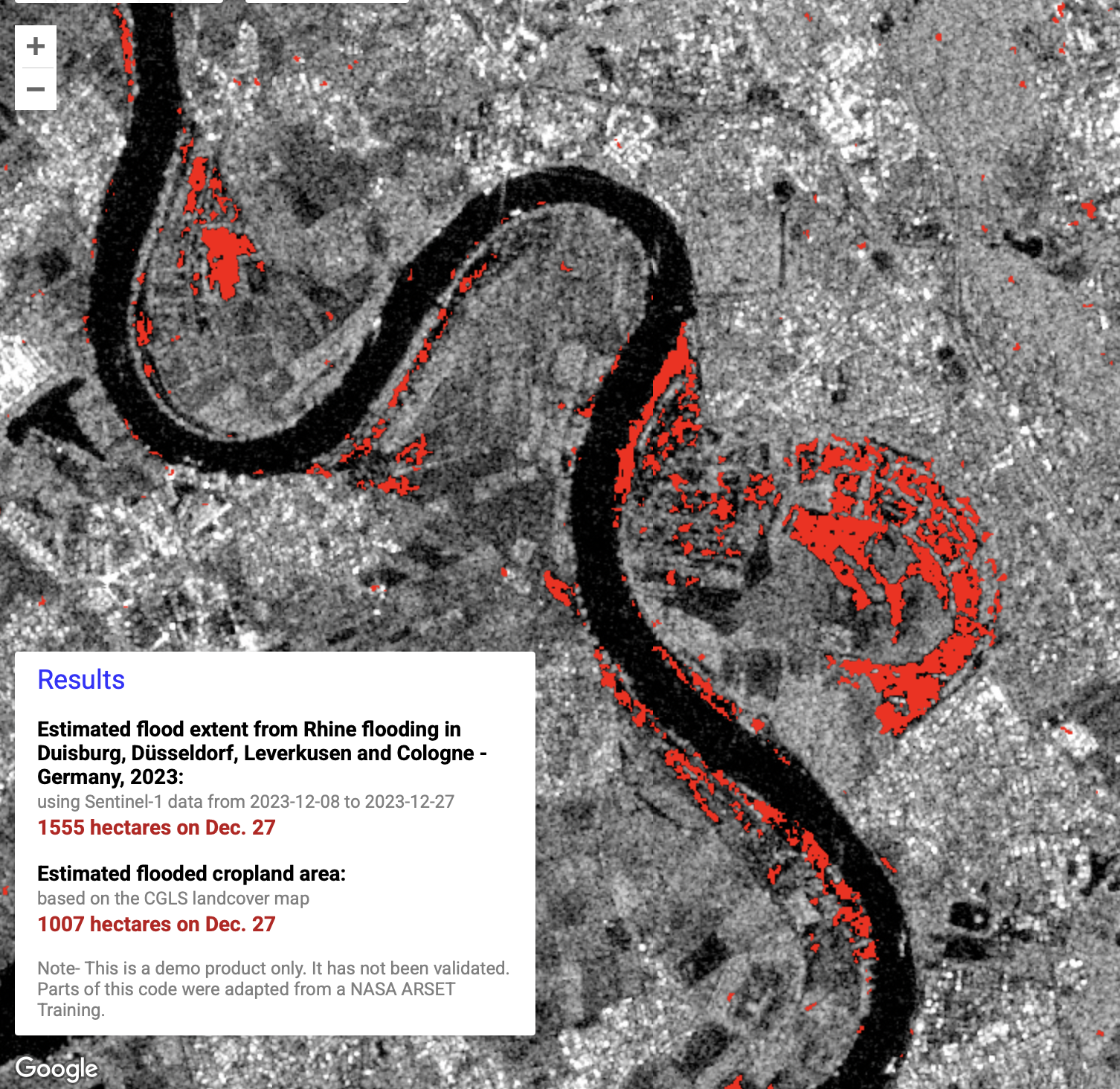
Rhine Flood Dashboard
Built GEE-powered system to visualise flooding extent and change over time for media reporting.
Client: Vertical52
Data: Sentinel-1
Stack: Google Earth Engine, SAR backscatter, JavaScript
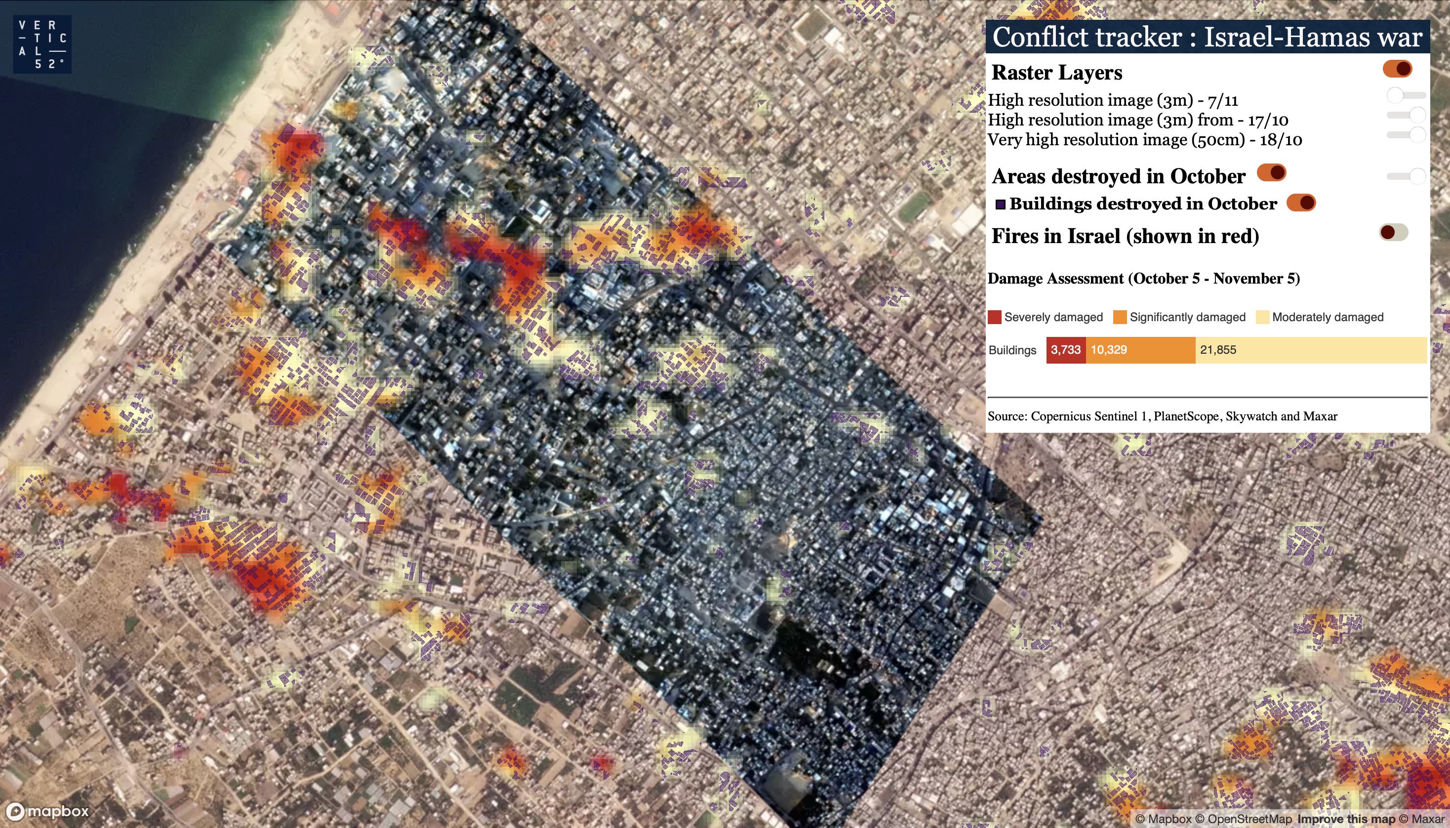
Gaza Damage Assessment
Architected building-level damage classification system. 35,000+ buildings assessed.
Media: Tagesspiegel, Stern, NZZ, Süddeutsche Zeitung
Data: Sentinel-1, PlanetScope, Maxar SecureWatch, Google Open Buildings, Microsoft Building Footprints
Stack: Python, SAR coherence, Change detection, Vector tiles, Mapbox GL JS
View portal | Stern | SZ | SZ 2 | Handelsblatt | NZZ
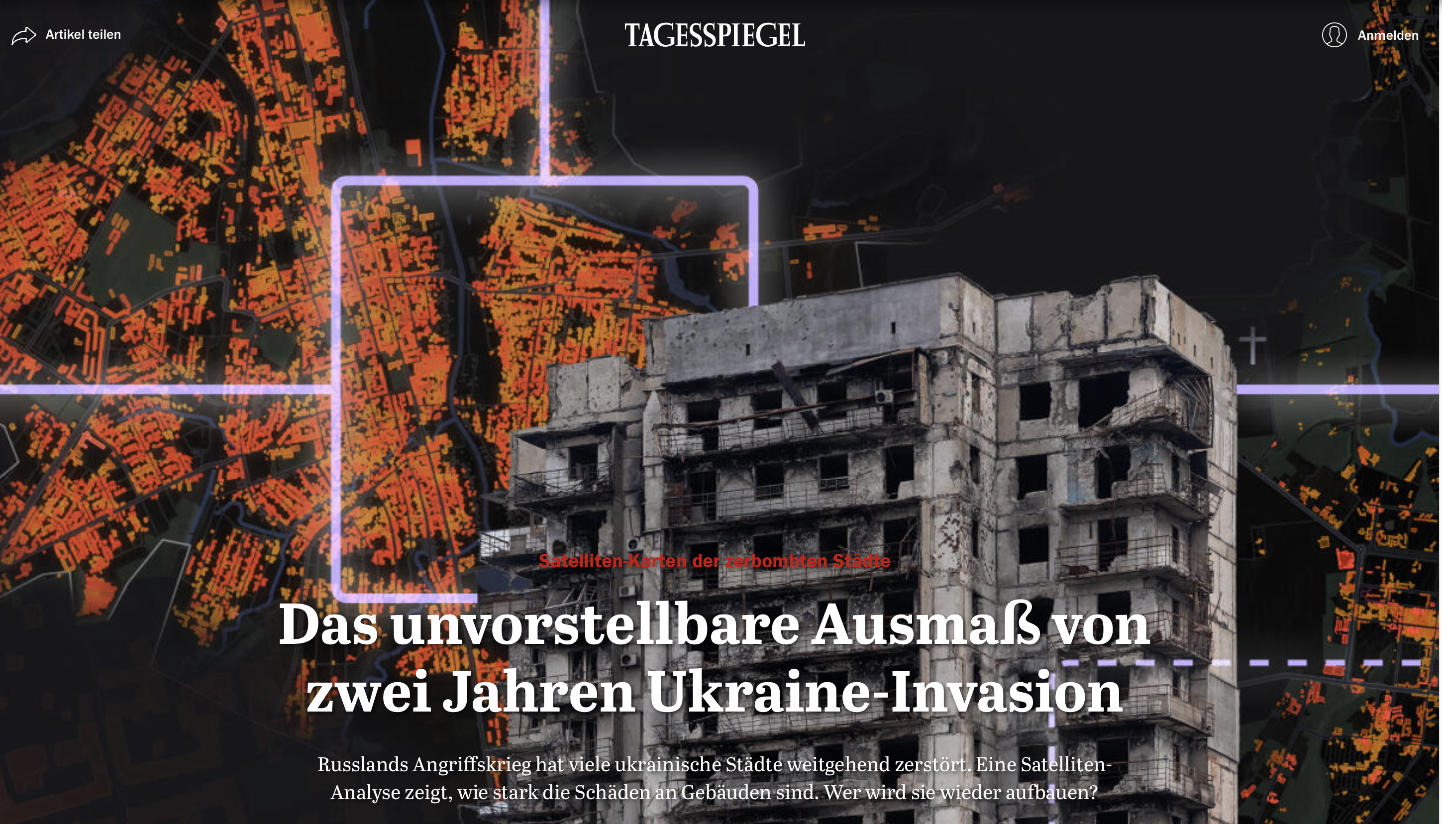
Ukraine Damage Mapping
Built SAR-based change detection pipeline for conflict damage assessment.
Media: Tagesspiegel, Süddeutsche Zeitung, Handelsblatt
Data: Sentinel-1 SAR, Microsoft Building Footprints
Stack: Python, InSAR coherence, Time-series change detection, Google Earth Engine
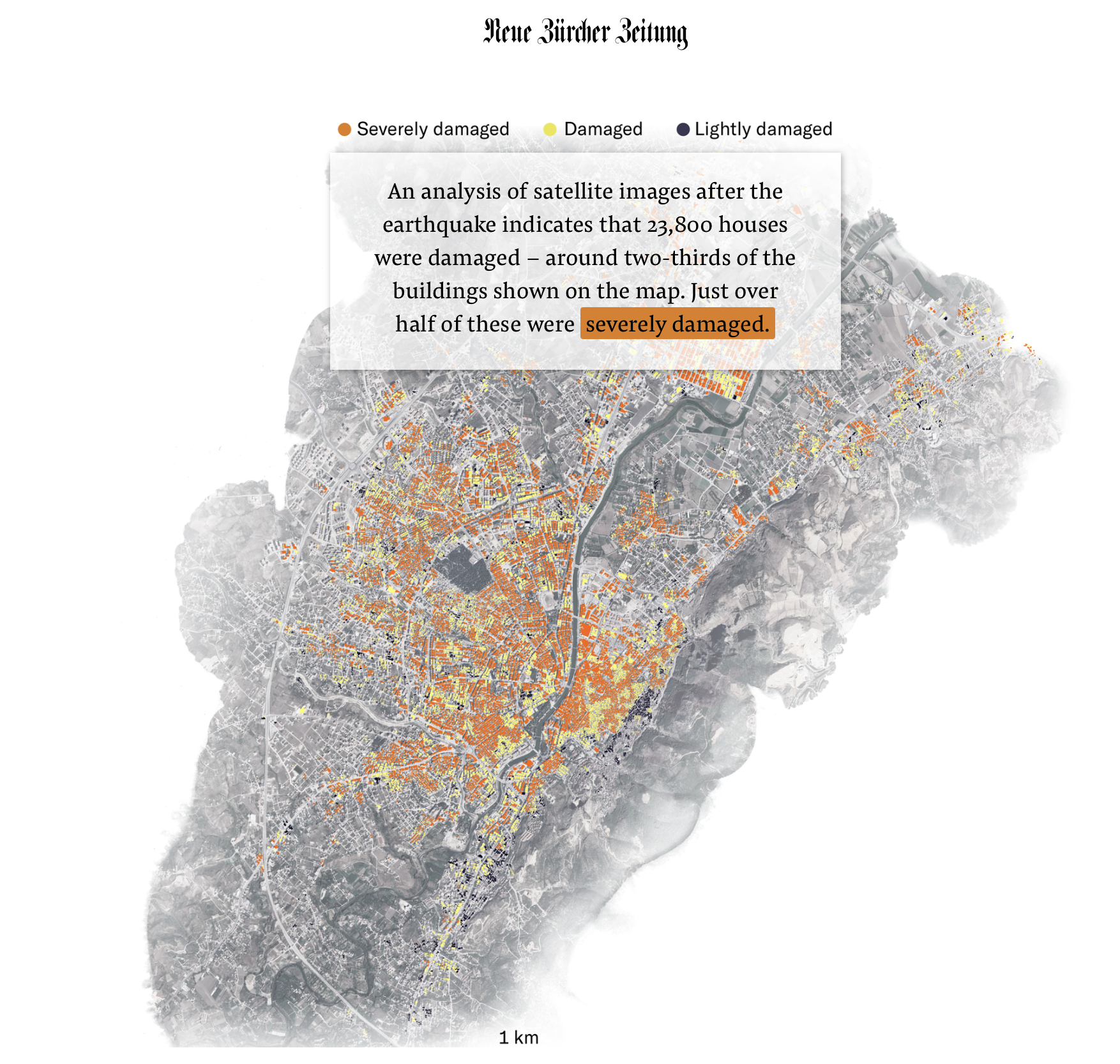
Turkey Earthquake Assessment
Built damage estimation system using remote sensing after the 2023 earthquake.
Media: NZZ
Data: Sentinel-1, Optical VHR, Microsoft Building Footprints
Stack: Python, Coherence change detection, Damage classification
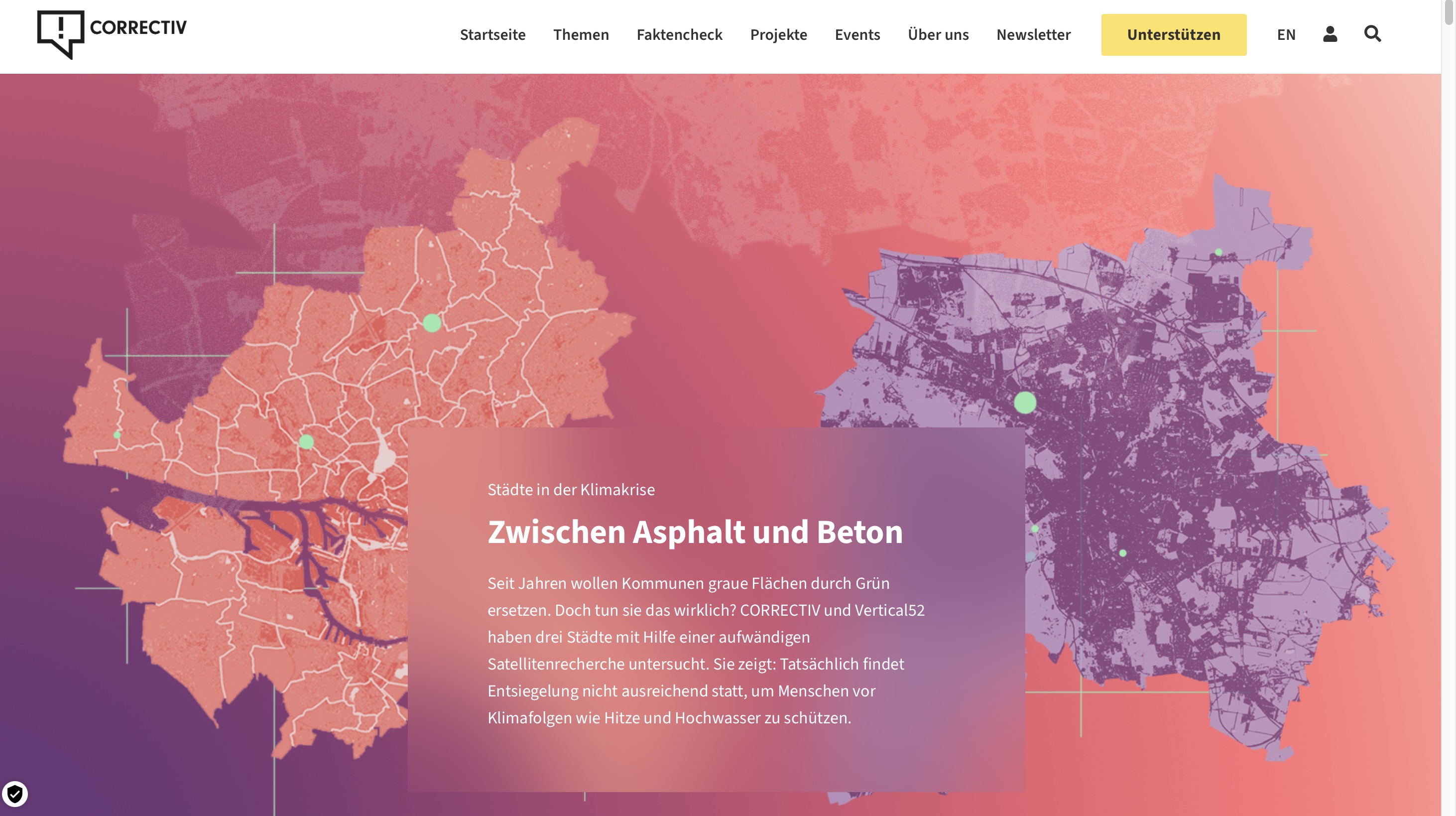
German Cities Imperviousness
Designed urban surface classification system across 5 German cities for investigative journalism.
Client: Correctiv, NDR | Funding: IJ4EU
Data: Sentinel-2, PlanetScope, RapidEye
Stack: Python, Computer vision, VHR classification, Google Earth Engine
Election Data Analysis
Built data science and visualisation system for election analytics at Centre for Policy Research, New Delhi.
Organisation: Centre for Policy Research
Data: Constituency-level polling data
Stack: R, Shiny, ggplot2, LaTeX
Research
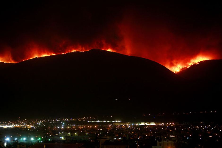
Fire Burned Area Detection
Co-authored peer-reviewed paper comparing burned area detection methods in Central India.
Publication: Frontiers in Forests and Global Change
Collaboration: Prof. Meghna Agarwala (Columbia University)
Data: Landsat-5 via Microsoft Planetary Computer
Stack: Python, PySTAC, Cloud Optimized GeoTIFF, scikit-learn